Upcoming Weather Conditions in Central India: Rainfall on the Horizon?


 Upcoming Weather Conditions in Central India: Rainfall on the Horizon?

As we move into the changing season, Central India is gearing up for a possible spell of rainfall in the coming days. With fluctuating temperatures and increased cloud cover, there is a high probability of showers across various regions, bringing relief from the dry and warm conditions experienced in the past weeks.

Weather Pattern and Possible Rainfall

A combination of atmospheric factors, including moisture incursion from surrounding areas and developing weather systems, is expected to contribute to light to moderate rainfall in several parts of Central India. States like Madhya Pradesh, Chhattisgarh, and Maharashtra may experience sporadic showers, particularly in isolated regions.

Impact on Temperature and Environment

With the arrival of rain, temperatures are likely to dip slightly, offering much-needed respite from the ongoing heat. The increased humidity might make the weather feel slightly warmer initially, but a fresh spell of cool winds post-rain will enhance comfort levels.

Effects on Agriculture and Daily Life

For farmers, this rainfall could be a boon, particularly for Rabi crops and early Kharif crop preparations. However, unseasonal heavy showers could pose a risk to standing crops. Urban areas might witness temporary waterlogging or disruptions in daily commuting due to sudden downpours.

Precautionary Measures

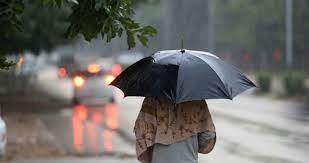
  • Keep an umbrella or raincoat handy while stepping out.

  • Farmers should stay updated with local advisories regarding weather changes.

  • Drivers should be cautious of slippery roads due to the first rain.

  • Those prone to respiratory issues should take precautions against increased humidity levels.

As the sky turns cloudy and the first drops fall, Central India can look forward to some much-needed rain. Stay prepared, stay safe, and embrace the refreshing change in weather!

Scorching Summer Ahead: Heatwave-Like Conditions Likely in Odisha, Maharashtra, and South Bengal


Scorching Summer Ahead: Heatwave-Like Conditions Likely in Odisha, Maharashtra, and South Bengal

As we step further into summer, temperatures are set to soar in several parts of India, with heatwave-like conditions expected in some regions of Odisha, Maharashtra, and South Bengal. The rising mercury, coupled with dry winds and clear skies, is likely to make the coming days particularly harsh for residents.

Odisha Braces for Intense Heat

Odisha, known for its extreme summer conditions, is once again on high alert. Some parts of the state, especially interior districts, are expected to experience soaring temperatures that could feel unbearable. The lack of moisture in the air and the presence of strong sunlight will likely push daytime temperatures above normal, making it essential for people to stay hydrated and avoid prolonged exposure to the sun.

Maharashtra: Nagpur and Kalyan-Dombivli to Feel the Heat

Nagpur, often referred to as the "Tiger Capital of India," is also earning a reputation for being one of the hottest cities during the summer months. With temperatures expected to rise significantly, the heat stress could be intense, affecting daily life. Similarly, Kalyan-Dombivli, located in the Mumbai Metropolitan Region, is likely to witness unusually high temperatures, making commuting and outdoor activities difficult. The combination of urban heat and a lack of widespread greenery in some areas could make the situation worse.

South Bengal: A Scorching Spell on the Horizon

Parts of South Bengal, including cities like Kolkata, may also see a spike in temperatures. Although Kolkata benefits from the occasional thunderstorm, the current weather patterns suggest that extreme heat could dominate before any relief arrives. The combination of high temperatures and humidity might lead to discomfort and increased health risks, particularly for vulnerable groups such as the elderly and children.

Precautions to Stay Safe

With these heatwave-like conditions on the horizon, it's crucial to take some preventive measures:

  • Stay Hydrated: Drink plenty of water and fluids like buttermilk, lemon water, and coconut water.

  • Avoid Direct Sun Exposure: Try to stay indoors during peak afternoon hours (12 PM - 4 PM).

  • Wear Light Clothing: Opt for loose, light-colored, and breathable fabrics like cotton.

  • Use Sun Protection: Carry an umbrella, wear a hat, and apply sunscreen when stepping out.

  • Limit Strenuous Activities: Avoid excessive physical exertion, especially outdoors.

The heatwave season is just beginning, and it is important to remain cautious. As temperatures climb, taking proactive steps to stay cool and safe is essential. Stay informed, stay prepared, and most importantly, stay hydrated!


Would you like any modifications or additional details?

Upcoming Rainfall Possibility in Central India from April 1st


Upcoming Rainfall Possibility in Central India from April 1st

As April begins, the weather in Central India, particularly in Maharashtra and Madhya Pradesh, is expected to transition into a crucial phase. The summer heat is intensifying, but there are chances of localized rainfall in certain areas due to pre-monsoon activities. Let's take a closer look at the expected rainfall pattern and weather conditions in these states.


Maharashtra: Potential Rain and Rising Heat

Mumbai & Konkan Region

Mumbai and the surrounding Konkan belt are likely to remain mostly dry with warm and humid conditions. However, occasional cloud cover may bring short spells of light rain, particularly in coastal areas, due to moisture incursion from the Arabian Sea.

Vidarbha (Nagpur, Chandrapur, Akola, Amravati)

The Vidarbha region, known for its extreme heat during this time, might experience isolated thunderstorms from April 2nd to 5th. These storms could bring short but intense showers, primarily in the late afternoons or evenings, triggered by the heating effect and local moisture interaction.

Pune & Western Maharashtra

Pune and its neighboring districts are expected to see partly cloudy skies with a slight chance of drizzle or light rain in some pockets, especially towards the Western Ghats. However, most of the region will remain warm, with daytime temperatures soaring above 38°C.


Madhya Pradesh: Dry Conditions with Isolated Rain

Bhopal & Central MP

Bhopal and surrounding areas are expected to witness mostly dry and hot conditions, with temperatures likely to exceed 40°C. However, there is a small chance of localized thunderstorms around April 3rd and 4th, mainly in the afternoon.

Indore & Western MP

Western MP, including Indore, Ujjain, and Ratlam, is likely to remain dry with no significant rainfall. However, pre-monsoon activity could bring occasional gusty winds and cloud cover in the first week of April.

Eastern MP (Jabalpur, Rewa, Satna)

Eastern parts of Madhya Pradesh, closer to Chhattisgarh, might experience isolated rain showers due to moisture incursion from nearby regions. However, widespread rainfall is unlikely.


Key Takeaways for April 1st Week:

  • Isolated thunderstorms are possible in Vidarbha (Maharashtra) and parts of Madhya Pradesh between April 2nd and 5th.

  • Hot and dry conditions will dominate most of Maharashtra and MP, with temperatures crossing 40°C in many areas.

  • Mumbai & coastal Maharashtra may see humid weather with some cloud cover but no significant rain.

  • Farmers should take precautions, as the rainfall will be scattered and unpredictable.

As always, weather patterns can change, so it's advisable to stay updated with local forecasts. Stay hydrated and take necessary precautions against the rising heat! ☀️đŸŒĻ

Rainfall Expected in Arunachal Pradesh Over the Next Three Days


Rainfall Expected in Arunachal Pradesh Over the Next Three Days

Arunachal Pradesh is set to experience varying weather conditions over the next three days, with rainfall anticipated in certain regions. If you're in the state or planning a visit, here’s what you need to know about the upcoming weather.

Rainfall Forecast

Itanagar

The capital city is expected to remain mostly dry, with warm temperatures during the day and slightly cooler nights. While cloud cover may increase, significant rainfall is unlikely. However, occasional light drizzles cannot be ruled out in some parts.

Tawang

Tawang and surrounding high-altitude areas are likely to experience cloudy weather with intermittent rainfall. The afternoons could bring light showers, with temperatures remaining relatively cool. Travelers should be prepared for sudden rain, especially in the evening.

Pasighat

Pasighat, known for its humid climate, may witness scattered showers, especially in the mornings and late afternoons. The region will see a mix of sun and clouds, with temperatures remaining warm but bearable.

Weather Patterns and Seasonal Context

March typically brings varying precipitation levels to Arunachal Pradesh, particularly in the hilly areas where moisture-laden winds from the Himalayas contribute to localized rainfall. This time of the year also marks the transition from winter to pre-monsoon conditions, resulting in occasional showers.

Precautions for Residents and Travelers

  • Stay Updated: Keep an eye on local weather forecasts for any changes in rainfall intensity.

  • Travel Preparedness: If traveling to hilly regions like Tawang, carry rain gear and be cautious of slippery roads.

  • Health Considerations: In areas with high temperatures, such as Itanagar, ensure adequate hydration and avoid extended exposure to direct sunlight.

With proper precautions, residents and visitors can navigate the upcoming weather safely while enjoying the beauty of Arunachal Pradesh’s landscapes.

Pleasant Spring Weather in New Delhi: Clear Skies & Mild Temperatures Ahead


Pleasant Spring Weather in New Delhi: Clear Skies & Mild Temperatures Ahead

As March progresses, New Delhi is set to enjoy comfortable and stable weather conditions in the coming days. The forecast predicts clear skies with a maximum temperature ranging between 32-34°C and a minimum of 19-21°C, making for pleasant mornings and warm afternoons.

Sunny Days with Comfortable Evenings

Residents can expect abundant sunshine during the daytime, ideal for outdoor activities. The clear sky will contribute to a slight increase in daytime temperatures, but the absence of high humidity will keep conditions comfortable. Evenings and early mornings will remain cool, providing relief from the afternoon warmth.

Impact on Daily Life

With no signs of rainfall or extreme weather, Delhiites can look forward to a consistent weather pattern. This is a great time for morning walks, outdoor sports, and general travel within the city. However, the increasing afternoon heat means staying hydrated and using sun protection is advisable.

Tips for the Week Ahead:

  • Stay Hydrated: As temperatures rise during the day, drinking plenty of water is essential.
  • Sun Protection: Sunglasses, hats, and sunscreen can help protect against direct sun exposure.
  • Ideal Time for Outdoor Activities: Mornings and evenings will be the most comfortable parts of the day.

Looking Ahead

As New Delhi moves deeper into the spring season, temperatures will gradually rise, signaling the approach of summer. For now, residents can make the most of this clear and pleasant weather before the peak heat of April and May sets in.

Stay tuned for regular weather updates to plan your days better!

Rising Temperatures in Maharashtra: Heatwave Conditions Likely Along Konkan Coast


Rising Temperatures in Maharashtra: Heatwave Conditions Likely Along Konkan Coast

As the summer season intensifies, Maharashtra is set to experience a significant rise in temperatures, with the Konkan coastal belt bracing for possible heatwave conditions. The India Meteorological Department (IMD) has warned of soaring mercury levels in cities like Mumbai, Ratnagiri, Sindhudurg, Raigad, and Thane, potentially impacting daily life and public health.

Heatwave Alert for Konkan Region

The normally humid and relatively moderate coastal areas of Maharashtra are now facing an unusual temperature surge. The upcoming weeks may witness temperatures exceeding 38-40°C in certain locations, coupled with high humidity, making conditions even more unbearable.

Mumbai, known for its sticky summers, could see temperatures crossing 35°C, with the heat index (real feel) being even higher due to excessive moisture in the air. Similarly, Sindhudurg and Raigad districts are expected to touch 40°C, a rare occurrence for these coastal regions.

Impact on Public Health and Daily Life

With the mercury rising, residents need to take precautionary measures against heat-related illnesses such as dehydration, heat exhaustion, and heatstroke. The elderly, children, and individuals with pre-existing health conditions are particularly vulnerable.

  • Stay Hydrated: Increase water intake to prevent dehydration.
  • Avoid Outdoor Exposure: Limit outdoor activities between 10 AM and 4 PM when the sun is at its peak.
  • Wear Light Clothing: Opt for cotton or linen clothes to stay cool.
  • Use Cooling Measures: Air-conditioned spaces, cool showers, and fans can help regulate body temperature.

What Authorities Are Doing

In response to the heatwave threat, local authorities and the IMD are closely monitoring temperature trends. Advisory messages are being issued to ensure public safety, while medical facilities are on alert for heat-related emergencies.

Moreover, civic bodies are urging citizens to conserve water and electricity, as higher demand is expected in the coming days.

Looking Ahead

Weather experts predict that the extreme heat spell may persist for the next few weeks before the pre-monsoon showers bring relief. Until then, it is crucial for residents to take all necessary precautions and stay informed about weather updates.

As Maharashtra grapples with the effects of rising temperatures, proactive measures can help mitigate the impact of this unusual heatwave along the Konkan coast.

The Connection Between Cyclones and Summer in India


The Connection Between Cyclones and Summer in India

India experiences a unique interplay between summer and cyclones, with the months of April to June marking a critical period for tropical storm formation. While summer is often associated with heatwaves and rising temperatures, it also sets the stage for cyclonic activity, especially in coastal regions. But what is the relationship between summer and cyclones in India? Let’s explore this dynamic connection.

How Summer Fuels Cyclones

Cyclones form due to a combination of warm ocean waters, atmospheric instability, and moisture-laden winds. During the summer months, particularly in the pre-monsoon season, the Indian Ocean and the Bay of Bengal absorb vast amounts of heat. This leads to an increase in sea surface temperatures, often exceeding 28°C, which provides the essential energy for cyclone development.

The heat also creates low-pressure areas over the ocean, pulling in moist air from the surroundings. This warm, rising air condenses to form clouds, releasing latent heat, which further intensifies the system into a cyclone. Thus, summer plays a direct role in fueling cyclones in India.

Regions Prone to Cyclones in Summer

India’s long coastline makes it vulnerable to tropical cyclones, especially in two primary regions:

  1. Bay of Bengal: This region sees frequent and more intense cyclones due to its warmer waters and conducive atmospheric conditions. States like Odisha, West Bengal, and Andhra Pradesh often bear the brunt of these storms.
  2. Arabian Sea: Though historically less active, the Arabian Sea has witnessed a rise in cyclonic activity in recent years, affecting Gujarat, Maharashtra, and Kerala.

Cyclone Seasons: Pre-Monsoon and Post-Monsoon

Cyclones in India mainly occur in two seasons:

  • Pre-Monsoon (April to June): This period sees the formation of summer cyclones, which can be devastating due to their rapid intensification. Examples include Cyclone Amphan (May 2020) and Cyclone Fani (May 2019).
  • Post-Monsoon (October to December): After the monsoon recedes, the warm ocean waters remain a breeding ground for cyclones, such as Cyclone Titli (October 2018) and Cyclone Phailin (October 2013).

Impact of Climate Change on Cyclone Activity

Rising global temperatures are influencing the frequency and intensity of cyclones. Climate models indicate that warming oceans are leading to:

  • Stronger and more intense cyclones
  • Unpredictable cyclone tracks
  • Increased cyclone formation in the Arabian Sea
  • Higher storm surges and flooding

Precautionary Measures and Disaster Preparedness

Given the destructive nature of cyclones, India has significantly improved its early warning systems and disaster preparedness. Coastal communities are now better equipped with cyclone shelters, evacuation plans, and improved forecasting techniques to mitigate damage and loss of life.

Conclusion

While summer in India is synonymous with scorching temperatures, it also acts as a catalyst for cyclones. Understanding this connection is crucial for better preparedness and resilience against these natural disasters. With climate change altering traditional cyclone patterns, vigilance and adaptation strategies are more important than ever to safeguard lives and livelihoods in coastal regions.

Meteora Weather Service: Accurate Forecasting for South Bengal


Meteora Weather Service: Accurate Forecasting for South Bengal

At Meteora Weather Service, we take pride in delivering precise and reliable weather predictions to help individuals, businesses, and farmers prepare for changing weather conditions. Today, our forecast for rainfall in South Bengal proved to be highly accurate, as showers were recorded in Purulia, Bankura, and Bardhaman, just as we predicted.

Our team of expert meteorologists, supported by state-of-the-art weather monitoring technology and data analysis tools, works around the clock to analyze atmospheric patterns and climatic conditions. By continuously monitoring satellite images, pressure systems, and humidity levels, we ensure that our forecasts remain highly accurate and beneficial for the people who depend on them.

The recent rainfall in these regions has brought much-needed relief from rising temperatures and dry conditions. This precipitation plays a crucial role in replenishing groundwater levels, improving soil moisture, and supporting agricultural productivity. Farmers in these areas, who were anticipating rain to aid in crop growth, can now proceed with their agricultural activities more confidently. Additionally, the showers have provided some respite from the sweltering summer heat for residents.

While rainfall is beneficial in many ways, we advise residents to stay updated on further weather developments. Sudden downpours can lead to localized waterlogging or disruptions in daily activities. As always, Meteora Weather Service remains committed to keeping the public informed with real-time updates and necessary precautions to ensure safety and preparedness.

We encourage everyone to stay connected with us for the latest weather forecasts and advisories. Follow us on our website and social media channels to receive timely updates, alerts, and expert insights into changing weather patterns. Your safety and preparedness are our top priorities, and we are here to help you stay ahead of the weather.

Trust Meteora Weather Service for accurate, timely, and reliable weather forecasting—because every drop of information matters!

The Nor’wester Season: Nature’s Fiery Spectacle


 The Nor’wester Season: Nature’s Fiery Spectacle

As the seasons shift and the air grows thick with humidity, a dramatic force of nature emerges in certain regions, known as the Nor’wester. This unique meteorological phenomenon, often witnessed in parts of India, Bangladesh, and Myanmar, is both awe-inspiring and fearsome. Known locally as 'Kalbaisakhi' in Bengal and 'Bordoisila' in Assam, Nor’westers are violent thunderstorms that bring heavy rain, strong winds, and sometimes even hail.

The Science Behind the Storms

Nor’westers form due to the clash between warm, moisture-laden air from the Bay of Bengal and cooler, dry air from northern India. As summer peaks, the scorching heat causes intense convection, leading to the rapid rise of warm air. When this air meets the upper atmospheric instability, cumulonimbus clouds build up, resulting in short but severe storms. These storms typically occur during late afternoons and evenings, often bringing relief from the oppressive heat.

A Blessing and a Curse

While Nor’westers are infamous for their destructive potential, particularly in rural and urban areas, they also play a crucial role in the ecosystem. The heavy rainfall replenishes water bodies, aids in agricultural growth, and cools down the blistering summer heat. However, strong winds and lightning can cause widespread damage to infrastructure, uproot trees, and pose threats to human life. Farmers often suffer significant losses when these storms arrive unannounced, damaging crops like mangoes, jute, and wheat.

The Cultural and Historical Significance

Nor’westers are deeply embedded in the cultural and historical fabric of the regions they impact. In literature and folklore, these storms are often portrayed as symbols of nature’s power and unpredictability. Poets like Rabindranath Tagore and Jibanananda Das have immortalized these storms in their works, capturing both their fury and their fleeting beauty.

Staying Safe During a Nor’wester

As unpredictable as they are, Nor’westers require preparedness. Here are some safety tips to keep in mind:

  • Stay indoors and avoid open fields when a storm is approaching.
  • Secure loose objects that might be blown away by strong winds.
  • Avoid using electrical appliances during lightning strikes.
  • Farmers should monitor weather forecasts to prevent crop losses.

The Nor’wester’s Lasting Impact

Despite their destructive tendencies, Nor’westers serve as nature’s way of maintaining balance. They cool the air, provide much-needed water to parched lands, and remind us of nature’s raw power. Whether seen as a boon or a bane, the Nor’wester season remains one of the most fascinating weather phenomena in the subcontinent, a force both feared and revered.

Have you ever experienced the fury of a Nor’wester? Share your stories in the comments!

Western Disturbance Brings Rainfall to Delhi, Chandigarh, and Surrounding Areas


Western Disturbance Brings Rainfall to Delhi, Chandigarh, and Surrounding Areas

As the winter chill begins to give way to early hints of spring, a western disturbance is poised to bring some much-needed rainfall to Delhi, Chandigarh, and the nearby regions until March 17th. Whether you’re a local resident, a traveler, or simply someone who enjoys watching the changing seasons, here’s everything you need to know about the upcoming weather event.

A Glimpse into the Weather

For several years now, western disturbances have played a significant role in shaping the weather patterns of North India. This time, the system is expected to generate scattered showers, adding a refreshing touch to the region’s otherwise dry conditions. The rainfall may vary in intensity, so while some areas might experience light drizzles, others could see more robust showers.

What is a Western Disturbance?

A western disturbance is essentially a weather system that originates over the Mediterranean region. As it moves eastward, it interacts with the Himalayan foothills, resulting in cloud formation and precipitation over North India. These systems have been known to deliver timely rainfall that not only cools the atmosphere but also plays a vital role in the local water cycle.

How Will the Rain Affect the Region?

1. Urban Areas: Delhi and Chandigarh

  • Delhi: The capital is known for its bustling urban landscape and occasional extreme weather. The upcoming showers are likely to offer a brief respite from the dry, dusty air, providing some relief to residents and commuters.
  • Chandigarh: As a city celebrated for its greenery and design, Chandigarh will benefit from the rainfall. Expect a slight drop in temperature and a more vibrant cityscape as the raindrops help rejuvenate the local flora.

2. Surrounding Areas

The suburbs and rural areas around these cities will also witness some of the rainfall, which could help in watering local crops and improving soil moisture levels. Farmers and local communities might find the timely showers beneficial, especially in areas that have experienced a prolonged dry spell.

What to Expect in the Coming Days

  • Scattered Showers: The rainfall might not be continuous but rather intermittent, offering periods of clear skies in between.
  • Cooling Temperatures: With the rain comes a drop in temperature, making it a pleasant time for outdoor activities. However, it’s advisable to keep an umbrella handy.
  • Improved Air Quality: The onset of rain is likely to wash away some of the dust and pollutants, contributing to better air quality, which is a welcome change for many residents.

Tips for Residents and Visitors

  • Plan Your Day: Check local weather updates regularly as the intensity and timing of the showers may vary.
  • Stay Prepared: Carry rain gear if you’re heading out, especially during the peak hours of rainfall.
  • Driving Caution: Wet roads can be slippery. Drive carefully and allow extra time for your commute.
  • Enjoy Nature: The rainfall is a perfect opportunity to enjoy nature, whether it’s a walk in the park or simply watching the city transform under the drizzle.

Final Thoughts

The upcoming western disturbance is set to bring a refreshing change to Delhi, Chandigarh, and the surrounding areas, with rainfall expected until March 17th. It serves as a gentle reminder of the dynamic nature of our weather systems and the role they play in balancing the environment. As you adjust your plans to make the most of the rainy days, remember that every drop contributes to the lush greenery and the overall well-being of the region.

Stay tuned to your local weather updates and enjoy the rejuvenating showers that are on the horizon!

Scorching Heatwave Grips Konkan and Vidarbha: What You Need to Know


Scorching Heatwave Grips Konkan and Vidarbha: What You Need to Know

As summer tightens its grip, the regions of Konkan and Vidarbha in Maharashtra are experiencing intense heatwave conditions, with temperatures soaring well above normal. The blazing sun, rising humidity, and dry winds have made daily life difficult, prompting health warnings and advisories from authorities.

Unbearable Heat: Current Conditions

  • Vidarbha: Known for its extreme summers, this region has seen temperatures crossing 40°C in multiple cities, with Nagpur, Akola, and Chandrapur among the worst affected. The hot and dry winds sweeping across the region have intensified the discomfort.
  • Konkan: While typically known for its coastal breezes, parts of the Konkan region, including Mumbai, Thane, and Ratnagiri, have been experiencing higher-than-normal temperatures coupled with oppressive humidity. Some areas have reported a heat index ("feels-like" temperature) above 42°C due to the combination of heat and moisture in the air.

Why Is This Happening?

The heatwave is a result of a combination of climate patterns and atmospheric changes, including:

  • Delayed summer rains: A lack of pre-monsoon showers has left the land dry and unable to regulate temperature effectively.
  • Hot, dry winds from northwest India intensifying the heat over Vidarbha.
  • Urban heat island effect in cities like Nagpur and Mumbai, where concrete structures and lack of green cover worsen heat retention.

Impact on Daily Life

The soaring temperatures have led to:

  • Increased heat-related illnesses: Cases of dehydration, heat strokes, and fatigue are on the rise, especially among outdoor workers, elderly citizens, and children.
  • Water shortages: With rising demand, several rural areas in Vidarbha are already facing water scarcity, putting stress on daily life.
  • Disruptions in agriculture: Farmers are struggling as high temperatures impact crop yields and water availability for irrigation.

Precautions to Stay Safe

With the heatwave expected to persist, here are some essential precautions:
Stay Hydrated: Drink plenty of water, even if you don’t feel thirsty. Avoid excessive tea, coffee, and alcohol.
Wear Loose, Light Clothing: Cotton clothes in light colors help keep your body cool.
Avoid Direct Sun Exposure: Try to stay indoors between 12 PM to 4 PM, when the heat is at its peak.
Use Cooling Methods: Keep your surroundings cool by using fans, air coolers, and staying in shaded areas.
Eat Light: Fresh fruits, vegetables, and electrolyte-rich drinks help maintain energy levels.
Check on Vulnerable People: Elderly individuals, children, and those with medical conditions need extra care during this time.

Looking Ahead

Meteora Weather Service predict that the heatwave may continue for the next few days, with some relief expected only after mid-March. However, with summer just beginning, more extreme heatwaves are likely in the coming months. Authorities and health officials are urging people to remain cautious and follow safety guidelines to prevent heat-related complications.

As Maharashtra battles this scorching summer, let’s take every possible measure to stay safe and beat the heat! 🌞đŸ”Ĩ

Heavy Rainfall Expected in South India from Tomorrow Due to Bay of Bengal Circulation


Heavy Rainfall Expected in South India from Tomorrow Due to Bay of Bengal Circulation

South India is set to experience significant rainfall starting tomorrow afternoon due to a cyclonic circulation over the southwest Bay of Bengal near Sri Lanka. This system is expected to bring moderate to heavy showers, with some regions likely to see very heavy rainfall over the next few days.

Rainfall Forecast

Tamil Nadu & Puducherry

  • Widespread light to moderate rainfall with thunderstorms and lightning.
  • Heavy to very heavy rainfall is expected in districts like Kanyakumari, Tirunelveli, Tenkasi, and Thoothukudi.
  • Other regions such as Virudhunagar, Sivaganga, Mayiladuthurai, Thanjavur, Tiruvarur, Nagapattinam, Pudukottai, and Ramanathapuram may also receive heavy rainfall.

Kerala

  • Due to the influence of the circulation and easterly wave activity, Kerala is likely to see heavy rainfall on March 11 and 12.
  • Thunderstorms and strong winds may accompany the showers in some places.

Fishermen Advisory

  • Strong winds and rough seas are expected, making it unsafe for fishing activities in the southwest Bay of Bengal, Gulf of Mannar, Comorin area, and along the Tamil Nadu and Kerala coasts.
  • Fishermen are advised to avoid venturing into these areas until conditions improve.

Precautionary Measures

  • Keep track of weather updates and alerts from authorities.
  • Avoid traveling to low-lying flood-prone areas.
  • Secure loose objects outdoors to prevent damage from strong winds.
  • Fishermen and coastal communities should take necessary precautions.

This upcoming rainfall event highlights the impact of Bay of Bengal weather systems on South India. People in the affected areas should stay prepared for possible disruptions and follow safety measures accordingly.

Upcoming Heatwave Alert for the Konkan Coast: What You Need to Know


Upcoming Heatwave Alert for the Konkan Coast: What You Need to Know

As summer approaches, the Konkan coast—stretching from Maharashtra to Goa—is gearing up for a spell of intense heat. Meteorologists predict a rise in temperatures, with certain regions expected to experience heatwave conditions in the coming days. If you’re in cities like Mumbai, Ratnagiri, Sindhudurg, or Goa, it’s time to prepare for the scorching days ahead.

What to Expect?

  • Rising Temperatures: Maximum temperatures are expected to soar between 36-40°C, with humidity making it feel even hotter.
  • Hot and Humid Conditions: The coastal belt will witness high moisture levels, leading to an increase in discomfort.
  • Prolonged Heatwaves: The hot spell could last for several days, affecting daily life, health, and work conditions.

Why Is This Happening?

Heatwaves along the Konkan coast are usually triggered by a combination of factors:

  • Delayed Sea Breeze: The usual cooling effect from the Arabian Sea gets disrupted, leading to persistent high temperatures.
  • Anticyclonic Systems: A lack of strong weather systems can cause hot air to settle over the region.
  • Urban Heat Island Effect: Cities like Mumbai experience additional heating due to concrete structures trapping heat.

Precautionary Measures

To stay safe during this heatwave, follow these simple yet effective precautions:

1. Stay Hydrated

  • Drink plenty of water throughout the day.
  • Avoid excessive caffeine and alcohol as they dehydrate the body.
  • Consume fruits and vegetables with high water content, like watermelon and cucumber.

2. Avoid Direct Sun Exposure

  • Stay indoors between 11 AM and 4 PM, when the sun is at its peak.
  • If you must step out, wear sunglasses, a hat, and loose, light-colored clothing.
  • Apply sunscreen to protect your skin from sunburn.

3. Keep Your Home Cool

  • Use curtains, blinds, or reflective covers to block direct sunlight.
  • Keep windows open during cooler hours for ventilation.
  • Use fans and air conditioners efficiently to maintain comfortable indoor temperatures.

4. Be Cautious of Heat-Related Illnesses

  • Symptoms of heat exhaustion include dizziness, excessive sweating, and nausea.
  • Heatstroke, a severe condition, causes high fever, confusion, and unconsciousness—seek immediate medical help if these occur.

5. Check on Vulnerable Individuals

  • Keep an eye on the elderly, children, and pets, as they are more susceptible to heat-related health risks.
  • Ensure workers in outdoor occupations take frequent breaks and stay hydrated.

Looking Ahead

The heatwave is expected to continue for several days, so it’s crucial to remain vigilant and adapt daily routines accordingly. The pre-monsoon period typically sees extreme temperatures before relief arrives with the southwest monsoon. Until then, staying informed and taking precautions will be key to avoiding health hazards.

Stay safe, stay cool, and take care of yourself and those around you! 🌞đŸ”Ĩ

Western Disturbance to Bring Rainfall Over North India from March 13


Western Disturbance to Bring Rainfall Over North India from March 13

A fresh Western Disturbance is set to impact parts of northern India, bringing rainfall and possible snowfall to Jammu & Kashmir, Himachal Pradesh, Uttarakhand, Chandigarh, and adjoining areas from March 13, 2025. This weather system is expected to bring much-needed precipitation but could also lead to localized disruptions.

What is a Western Disturbance?

Western Disturbances are weather systems originating in the Mediterranean region, which move eastward and influence the weather patterns of North India. They bring rainfall in the plains and snowfall in the mountains, playing a crucial role in winter and early spring precipitation.

Weather Forecast (March 13-15, 2025)

Jammu & Kashmir

  • Srinagar: Cloudy skies with light to moderate rainfall; possibility of snowfall in higher reaches.
  • Jammu: Thunderstorms and showers likely, with cooler temperatures.

Himachal Pradesh

  • Shimla, Manali: Scattered rain showers and thunderstorms expected.
  • Lahaul-Spiti, Kinnaur: Higher elevations may witness snowfall.

Uttarakhand

  • Dehradun, Mussoorie, Nainital: Rain showers with possible thunderstorms.
  • Higher elevations: Light snowfall likely in Kedarnath, Badrinath, and nearby peaks.

Chandigarh & Punjab

  • Cloudy conditions with light rainfall expected on March 13-14.
  • A drop in temperatures likely post-rainfall.

Potential Impacts

  • Agriculture: Beneficial for Rabi crops like wheat, but excess rain may lead to waterlogging.
  • Travel Disruptions: Snowfall in hilly areas could lead to road blockages and traffic disruptions.
  • Urban Areas: Temporary waterlogging in some cities.

Safety Tips

  • Travelers: Check weather updates before visiting hilly regions.
  • Farmers: Protect standing crops and ensure proper drainage.
  • Residents: Keep warm, and avoid unnecessary travel in affected regions.

This Western Disturbance will help replenish water sources and improve soil moisture but may also pose temporary challenges. Stay updated on weather forecasts and take necessary precautions.

The Heat is On: Summer Has Arrived – Stay Cool and Safe!


The Heat is On: Summer Has Arrived – Stay Cool and Safe!

Summer has officially entered the country, bringing longer days, warm breezes, and, of course, intense heat. While many look forward to beach trips, vacations, and outdoor fun, the rising temperatures can also pose health risks. It is essential to be prepared and take necessary precautions to stay cool, hydrated, and safe during the hot days ahead.

What to Expect This Summer

With summer in full swing, temperatures are expected to rise significantly in the coming weeks. Heatwaves, high humidity, and prolonged exposure to the sun can lead to heat-related illnesses such as heat exhaustion and heat stroke. Some regions may also experience erratic weather patterns, including dry spells or sudden thunderstorms. It’s crucial to stay informed about the daily weather forecast and plan activities accordingly.

Essential Precautions to Beat the Heat

To ensure you and your loved ones remain safe and comfortable during the summer months, consider the following precautions:

1. Stay Hydrated

Drink plenty of water throughout the day, even if you don’t feel thirsty. Avoid excessive caffeine or alcohol consumption, as these can lead to dehydration.

2. Wear Light and Breathable Clothing

Opt for light-colored, loose-fitting, and lightweight fabrics such as cotton or linen to help your body stay cool.

3. Avoid Direct Sun Exposure During Peak Hours

The sun’s rays are strongest between 10 AM and 4 PM. If possible, limit outdoor activities during these hours, or seek shade when outside.

4. Use Sunscreen and Protective Gear

Apply sunscreen with at least SPF 30 before heading outdoors. Wearing sunglasses, hats, and carrying an umbrella can further protect against harmful UV rays.

5. Keep Indoor Spaces Cool

Use fans, air conditioners, or keep windows open during cooler hours to maintain airflow. If you don’t have air conditioning, visit public places like malls or libraries to escape the heat.

6. Eat Light and Fresh Meals

Heavy, greasy meals can increase body heat. Opt for hydrating fruits and vegetables like watermelon, cucumber, and citrus fruits to keep your body refreshed.

7. Take Cool Showers or Baths

A refreshing shower can help lower body temperature and keep you feeling fresh throughout the day.

8. Be Cautious of Heat-Related Illnesses

Know the symptoms of heat exhaustion (dizziness, excessive sweating, nausea) and heat stroke (confusion, rapid pulse, loss of consciousness). Seek immediate medical attention if symptoms appear.

Conclusion

As we embrace the summer season, it is vital to prioritize our health and well-being. By following these simple precautions, you can enjoy the sunny days while staying safe from extreme heat. Stay hydrated, dress appropriately, and be mindful of the weather conditions. Let’s make this summer enjoyable and hazard-free!

Stay cool, stay safe, and enjoy the season!

Rainfall Expected Over Andaman and Nicobar Islands from March 8


Rainfall Expected Over Andaman and Nicobar Islands from March 8

The Andaman and Nicobar Islands are set to experience a spell of rainfall starting from March 8, with showers being more prominent in the southern parts of the archipelago.

Weather Outlook

  • South Andaman & Nicobar: Light to moderate rainfall is likely at many places, with some areas experiencing occasional thunderstorms.
  • North & Middle Andaman: While rainfall is expected, it will be more scattered compared to the southern regions.

The intensity of rainfall is likely to peak around March 9-11, bringing cloudy skies and increased humidity. By March 12-13, a gradual reduction in rainfall activity is expected.

What to Expect

  • Increased cloud cover
  • Possible thunderstorms, particularly in South Andaman and Nicobar
  • Mild temperature variations with humid conditions

For those planning travel or outdoor activities in the region, it is advisable to stay updated on local weather reports and be prepared for occasional showers.

Summer's Arrival: What to Expect in March


Summer's Arrival: What to Expect in March

As winter bids farewell and we step into March, the first signs of summer begin to unfold across India. March marks the transitional phase from mild temperatures to gradually intensifying heat. With the sun moving northward, days start becoming longer, and the mercury begins to rise. Let’s take a look at what to expect in terms of weather and its effects in March.

Rising Temperatures

March typically experiences a noticeable increase in temperatures, particularly in the plains of North and Central India. Cities like Delhi, Jaipur, and Lucknow begin seeing daytime temperatures soar past 30°C, with some regions even touching 35°C. South India, including cities like Chennai, Hyderabad, and Bengaluru, will also experience warm days but relatively moderate conditions due to coastal influence.

Heatwave Possibilities

While March is still considered early for severe heatwaves, certain regions in Central and Western India—such as Maharashtra, Rajasthan, and Gujarat—may witness short-duration heat spells. These heatwaves, though not as intense as those in April and May, can still pose discomfort and health risks, especially in urban areas where concrete structures retain heat.

Effect on Agriculture

March is a crucial month for Rabi crops, as harvesting season nears. Crops such as wheat, mustard, and pulses require stable weather conditions. However, a sudden rise in temperatures can impact yield, especially for wheat, which needs cooler nights to develop properly. Additionally, early summer conditions can lead to water stress, making irrigation crucial for farmers.

Impact on Air Quality

With winter receding, the concentration of pollutants in the air may see some fluctuations. In cities like Delhi and Kolkata, the winter fog and smog start clearing up, leading to improved visibility. However, dust and dry conditions can still contribute to localized air pollution, especially in regions experiencing early summer dryness.

Pre-Monsoon Activity

March also marks the beginning of pre-monsoon weather activities in certain regions. Thunderstorms, locally known as Kalbaisakhi in eastern India, may start appearing towards the latter half of the month, particularly in West Bengal, Odisha, and Assam. These storms bring strong winds, lightning, and short but intense showers, providing temporary relief from the heat.

Precautions and Preparedness

With temperatures rising, it’s important to start adapting to summer conditions early:

  • Stay Hydrated: Increase water intake to avoid dehydration.
  • Avoid Peak Sun Hours: Minimize exposure to direct sunlight between 12 PM and 3 PM.
  • Use Sunscreen & Light Clothing: Protect your skin from harsh UV rays.
  • Monitor Weather Forecasts: Keep track of rising temperatures and any heatwave alerts.

Conclusion

March serves as the bridge between the cool winter months and the scorching summer days ahead. While the weather remains manageable for most, it sets the stage for harsher conditions in April and May. With a mix of rising temperatures, agricultural concerns, and pre-monsoon activities, March is a month of change and adaptation. Staying aware and taking necessary precautions will ensure a smooth transition into the summer season.

Upcoming Rainfall Expected in Northern Arunachal Pradesh


Upcoming Rainfall Expected in Northern Arunachal Pradesh

The northern parts of Arunachal Pradesh are likely to experience rainfall in the coming days due to the influence of an approaching weather system. While most of the northeastern region remains dry, the higher-altitude areas of Tawang, Upper Siang, Anjaw, Dibang Valley, and Kurung Kumey may witness light to moderate showers.

Weather Conditions Leading to Rainfall

  1. Moisture Incursion from the Eastern Himalayas – Winds carrying moisture from the nearby Tibetan plateau and the Himalayas are likely to trigger cloud formation.
  2. Western Disturbance Influence – A weak western disturbance may extend its impact to extreme northeastern India, supporting rainfall activity.
  3. Orographic Effect – The mountainous terrain of northern Arunachal Pradesh tends to trap moisture, leading to increased chances of precipitation.

Expected Weather Outlook

  • Rainfall Intensity: Light to moderate showers are expected, with isolated intense spells in high-altitude areas.
  • Temperature Impact: Day temperatures may drop slightly due to increased cloud cover, while nights will remain chilly.
  • Snowfall Possibility: Higher elevations, such as Tawang and areas above 3,000 meters, may witness light snowfall along with rain.

Potential Impact

  • Travel Disruptions – Rain and possible snowfall in higher reaches may cause roadblocks, especially along hilly routes.
  • Agriculture Effects – Farmers in the region should take precautions, as excess moisture could affect winter crops.
  • Cold Conditions – The drop in temperature may lead to colder-than-usual nights, so residents should be prepared.

Precautionary Measures

  • Travelers should check local weather updates before planning trips to higher altitudes.
  • Farmers should ensure proper drainage in fields to avoid water stagnation.
  • Residents should take necessary precautions against sudden cold weather due to rain and cloud cover.

Conclusion

While this rainfall will bring much-needed moisture to the region, residents should be prepared for wet and chilly conditions in the coming days. Stay updated with Meteora Weather Service for the latest weather forecasts and alerts.


Unseasonal Warmth in Central India: Temperatures Set to Touch 35°C


Unseasonal Warmth in Central India: Temperatures Set to Touch 35°C

Central India is set to experience an unusual rise in temperature over the next few days, with cities like Nagpur, Bhopal, Indore, Raipur, and Jabalpur expected to see daytime temperatures reaching 35°C. While winter conditions are still prevailing in many parts of North India, Central India is witnessing a shift toward warmer-than-usual weather.

Why Are Temperatures Rising?

  1. Clear Skies and Increased Sunshine: The absence of significant cloud cover is allowing more solar radiation to reach the surface, causing temperatures to rise.
  2. Weak Influence of Western Disturbances: Unlike North India, Central India is not seeing the effects of western disturbances, leading to stable weather and warming conditions.
  3. Gradual Seasonal Transition: February marks the beginning of a transition from winter to pre-summer, and occasional warm spells are common during this period.

Expected Weather Conditions

  • Daytime Temperatures: Likely to remain between 32°C and 35°C across most parts of Central India.
  • Night Temperatures: Expected to be around 15°C to 20°C, providing some relief after sunset.
  • Dry Air and Low Humidity: The weather will remain mostly dry, making afternoons feel warmer.

Possible Impact

  • Increased Discomfort: People working outdoors may feel the heat more during peak afternoon hours.
  • Agriculture Alert: Higher temperatures could impact crops that require cooler conditions at this stage.
  • Energy Demand: The use of cooling appliances like fans and air conditioners may see a slight increase.

Precautionary Measures

  • Stay hydrated and avoid direct exposure to the sun during noon hours.
  • Wear light and breathable fabrics to stay comfortable.
  • Farmers should monitor soil moisture levels and take necessary irrigation measures.

Conclusion

Though not unusual for this time of the year, the sudden rise in temperature is a reminder of the changing seasons. As Central India moves closer to summer, such warm spells will become more frequent. Stay updated with Meteora Weather Service for regular forecasts and weather insights.


Would you like to add specific district-wise temperature details?